2002 Q2 Vacation: 38°46.3195’N, 117°27.39441’W
Day 2: 17 May 2002
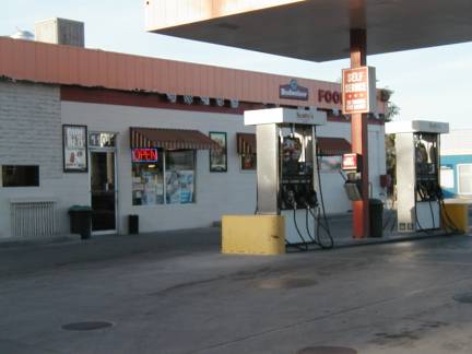
00:00 UTC – 02:00 UTC (Gas Crisis)
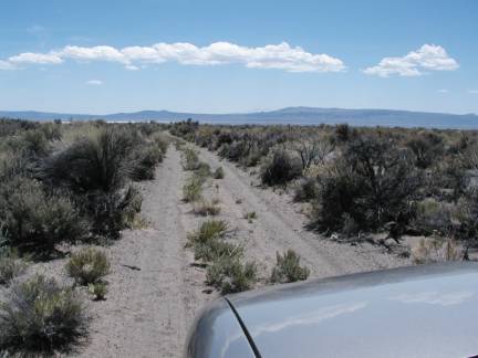
So as I continued, I approached someplace marked as Grantsville Summit. It was a small mountain (hill?) a few miles from Grantsville. I decided to take the side road up to the top as a little fun detour. After going a few feet into it, I decided I needed 4WD for this.
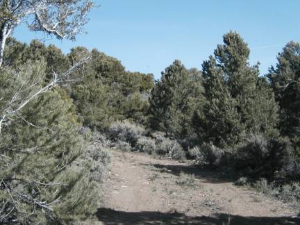
I switched into 4WD and climbed up to the top on the narrow steep dirt road. What a blast! I got to the top.
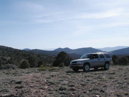
It was great.
Then I started to head back down. About half way down I suddenly see my gas gauge. It is pinned on “E”. What!!! I had had about half a tank left in Grantsville, just a few miles back! No! This was bad! How could this be!!! It was very steep where I was. Maybe I just wasn’t getting a good reading. Let me get back to the bottom. A few minutes later, at the bottom, and relatively flat again, the needle was slightly above E, but not very much. This was bad.
I asked the GPS where the nearest gas station was. It said there were NONE within the radius it considered. Urgh! So I ashed it where the nearest town was. Ione. About 10 miles away. OK. I would head there. As I drive, the gas meter creepys upward. By the time I get to Ione, it is showing a quarter tank. Ione is just a small cluster of buildings. One is marked as a general store, and says it has “gas and vittles”. But I don’t see a pump anywhere. And I have a quarter tank again. They probably did have gas in there somewhere. Just not a modern pump. I probably should have stopped and asked. But I decided to risk it and press on. I asked the GPS for the nearest lodging, figuring surely they would have gas too. So hotel/casino about 40 miles away as the crow flies.
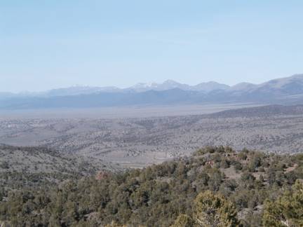
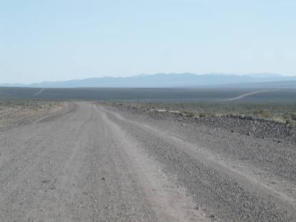
So I head out. I realize after a bit though, that the actual route to the spot is not 40 miles, but 140 miles. Because the roads don’t go in the right directions. That would be pushing it. And I look at the map. The route takes me 66 miles along a dirt road. Along this route there are NO towns between where I am and the town I’d be going to (Tonopah).
If I continued straight, the road was still paved, and it looked like there were a few more towns.
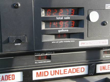
I kept going. It was a long way until the next town. When I got there my gas was on E again. There was a rest stop. I stopped. But there was no gas. Just a rest stop. And JUST a rest stop. No services. Just a place to park and a restroom. I contemplated what to do. Then I saw a sign to the right. “Truck stop, Hawthorne, 24 miles. Food, gas, showers.” It was the opposite direction from where I was headed. In the direction I was headed it was 80 miles to where I wanted to spend the night, and ten miles to the next town, which may or may not have gas. This was definite. There was gas. Could I make it 24 miles? I fired the Blazer back up again. It was reading one notch above E now. I would go for it.
I raced the 24 miles to Hawthorne. Now, I know going faster uses gas faster, but I was in a hurry. And I did turn off the AC to improve mileage. The last few miles into hawthorne the low fuel light was screaming at me from the dashboard. But I did make it.
On fumes as they say, but I made it. Whew!
02:00 UTC – 03:00 UTC (Dinner in Hawthorne)
After finally getting gas, I looked around for a place to eat. Just a little ways from the gas station I was at (I hadn’t gone to the actual truck stop) there was a little restaurant. So that’s what it would be. I ordered a nice little Mexican combo. It was good. It had been awhile since my last meal. Yum! I took my time and read some while I ate.
03:00 UTC – 05:00 UTC (To California)
After finishing the whole eating thing, it was time to think about where I wanted to stay the night. It wasn’t dark yet, but would be in a couple hours. Now, as it happened, I was parked in the parking lot of a motel. And there were quire a few places to stay in Hawthorne it seemed. But I wasn’t quite ready to stop for the night. So I checked the GPS for places further away. I settled on a Best Western near a lake… across the border in California, about an hour or two away. And off I went.
This was mostly a straight shot. Two lane road. Paved. Well maintained. I kept thinking I was going slowly, then would look down and realize I was going almost 90. The distances are all so large in this area, and there are so few “close” things to give you a sense of speed, it is easy to go fast. Um… I discovered that this Blazer has a limiter in at 100 mph. It automatically kicks back if you try to go that fast. J But most of the time I went in the mid 70’s probably.
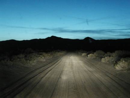
Once in California near the lake, I did go the last 15 miles or so on little dirt access roads to various ranches. That was fun.
But eventually I got to my hotel. They had vacancies. Whew!
05:00 UTC – 08:00 UTC (Lee Vining)
I basically just chilled in Lee Vining, the twon where the Lake View Best Western was. I watched some CNN and CNBC, I answered some email, I wrote some of this journal. It was once again that decompressing part of day.
08:00 UTC – 17:00 UTC (Sleep)
I fell asleep eventually and had a GOOD long sleep…
17:00 UTC – 18:00 UTC (Up)
Yawn! I could have slept longer, except once again there was that annoying 11 AM checkout. So I dragged myself up. Got all washed up, and headed out.
18:00 UTC – 23:00 UTC (Around Nevada)
Now, my trip to find lodging had taken me directly away from my spot. In fact, one thing I noticed as I left Lee Vining, was that I was only about 60 miles from my random spot in California from a few years back.
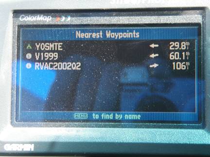
I was at the “East Gate to Yosemite”. My random spot from 1999 had been at the “West Gate”.
I could make a quick little detour pretty easily and visit it. And maybe get out of the car and get a little closer to the spot than I had last time. But no… that was that random trip, this was a new random trip, and it was time to try again. After a quick stop at the lake neat my motel.
And going on a few back roads near the lake…
Unfortunately going back to the random spot involved retracing my steps and reversing the route I had gone to get to Lee Vining. I don’t like going places I have already gone. I wanted an alternate route. I had also decided that when I got to half a tank of gas, I would immediately ask the GPS for the nearest gas station, and go there. So, as I’m rolling back into Hawthorne, I am hitting half a tank. So I do just that. Now, at this point I am staring at a gas station. It is 100 feet from where I was sitting in my car. But the closest one the GPS knew about was 55 miles to the northeast. I decide to head the 55 miles Northeast. Maybe going that way would then route me back to my spot through different roads.
Two hours later… I had driven to the gas station, then my route took me right back to Hawthorne again and I was once again at the same gas station I had been at before. I decided to get gas a second time just for the heck of it. My round trip to get gas can come back had cost me $5 worth of gas. Great.
About now would be a good time to mention a few things.
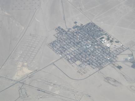
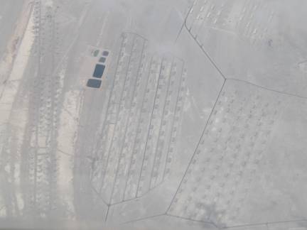
One, Hawthorne has a huge army depot. All sorts of underground bunker things sticking up all over the place. Very interesting. Also sort of makes sense. This is a good place to just store lots and lots of “stuff”. I didn’t get this at the time, but on the flight home I got a couple of shots of Hawthorne from the air where you can clearly see what I;m talking about.
This brings us to Two, Hawthorne also has an installation labeled the “Navy Undersea Warfare Division” or something similar. Uh… Navy… undersea… desert… Nevada… no water… it just doesn’t seem to mix right. Oh well!
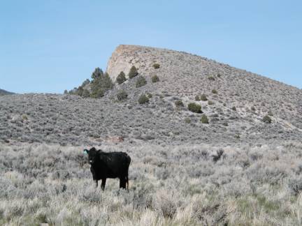
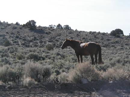
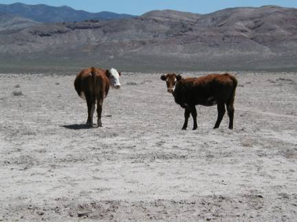
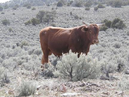
Third, and this isn’t so much a Hawthorne thing as a more general thing. Many of the highways I have been driving on the last few days, even the paved ones, are marked “open range”. This means there are cows and horses all over the place. By the side of the road. Sometimes on the road. Just wandering around. I saw bunches. I did not hit any.
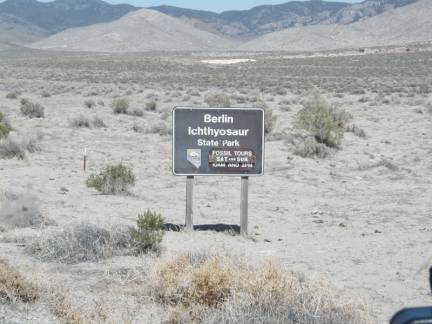
So, anyway, time to continue back toward the random spot. I followed many of the same roads I had a day previously. But as I approached the turn off onto a dirt road, I was following a horse trailer. And it went down the dirt road! Also, I knew that dirt road was the one to Grantsville. I wanted to see if I could find a different way. The fact that another person was going the Grantsville way synched it. I took a left instead of a right. This was too the roads eventually became dirt roads along my route. It seemed though that I was going in the direction of signs pointing to the Berlin-Icthyosaur state park. And soon, there it was.
23:00 UTC – 00:00 UTC (Berlin)
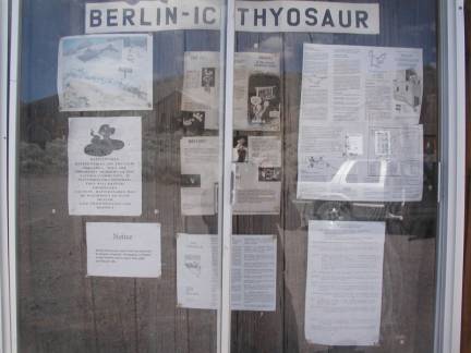
As I arrived at the gate, a park ranger walked over and took my 3 bucks. I had been intending to just go on through to the other side, but hey, since I’d paid my three bucks, I parked and looked around a little.
Berlin is an old ghost town that was put into a state of “suspended decay” to make it a state park.
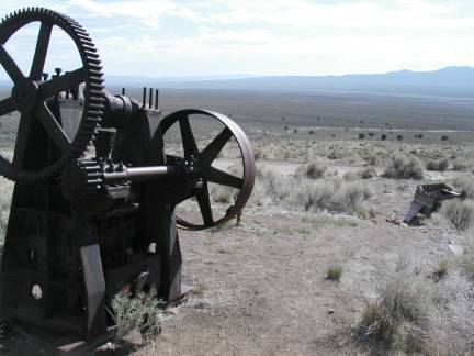
In other words, unlike the other ghost towns in the immediate area, it was protected from vandals and looters.
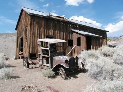
So a lot more buildings remain, and they are in slightly better shape.
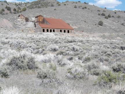
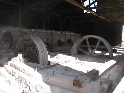
Berlin had actually been an active mining community from the late 1890’s to the early 1910’s. Each building, and various other features, had nice little historical signs saying what you were looking at.
Grantsville was very cool because it was in a very natural neglected state… this was nice in another way, because you could look at the decaying town, and at the same time read about the items, and learn a bit more than you could at a completely unlabeled town such as Grantsville.
I spent about an hour wandering around Berlin, then got back in my car. I went past the fossil area (which mentioned they did tours on Saturday, so I made a mental note to come back for that, as well as a mine tour back in Berlin). Then I headed out of the state park the back way.