Selection | Day 0 | Day 1 | Day 2 | Day 3 | Day 4
2002 Q3 Vacation: 51°1.90979'N, 71°11.76453'W
Day 2: Thu 2 Aug 2002
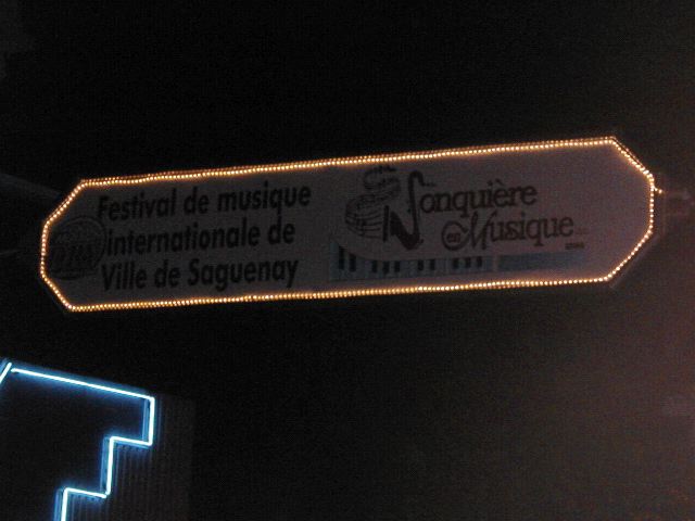
00:00 UTC - 04:00 UTC (Jonquiere en Musique)
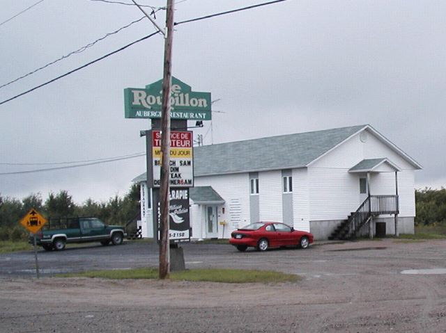
On the advice of my host, I headed to the town of Jonquiere for dinner. They were having a music festival of some sort. So after driving the half hour or so to get there, upon arriving in town I discovered the main street blocked off for the festival. I was able to snag the last spot in one of the parking lots, then walked toward the festival.
Once within the festival, I quickly found the main stage and was greeted by the sights and sounds of an Elvis impersonator in a sequined jumpsuit singing Frank Sinarta's "My Way" with a strong French accent. Ah yes. This was going to be good.
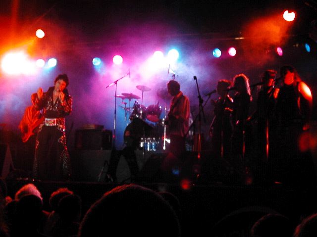
Over the course of the evening several acts performed on a couple different stages. The place was packed. The main street had been closed of fand there was a very decent croud listening and wandering about. In addition, both sides of the streets were lined with cafes and pubs, all of which were packed to capacity with people from the festival. Many of the cafes had outdoor seating where people could see the shows right from their seats.
I once again lament that the town where I currently live does not seem to have any nice main street with outdoor cafes and friendly pubs, supporting the occational lively cultural street festival. Oh well. I especially lament the cafes. I really like the cafes.
Speaking of which, I ate dinner at a place called the Puzzle, or something like that. Once again I had the same language difficulties and felt strongly out of place. But again, through strategic use of grunts and gestures, I was able to get my meal. And as I had done the previous day, I left a bit extra tip for the waitress having to deal with me.
After I finished eating it seemed like the festival was winding down anyway, so I decided to head back to the B&B for the night. As I left town I took a wrong turn and started going around a long loop back rather than the direct way. As soon as I realized it my initial inclination was to just take the long loop and explore. But after a few miles I realized I was pretty tired, so I made a U-turn and went back the short way.
04:00 UTC - 05:00 UTC (My Charger is Gone)
Once back in my bedroom, I sat down to check email and to start working on writing up the previous day's log. As I connected for email, my cell phone started complaining about low battery. So I looked for my charger cord. I could not find it. I quickly realized that I had left it on the table in the hotel room in Quebec City the previous day. I was very upset at myself. The cellphone power died before I could finish doing much of anything online. And I had no way to charge it. Not to mention the fact that I really didn't want to be without a usable cell phone. Argh! But there was nothing I could do about it at this time of day. I started writing up the log, but then realized just how tired I really was, and decided to just go to sleep and deal with it all in the morning.
05:00 UTC - 12:00 UTC (Sleep)
ZZZzzz...
12:00 UTC - 13:00 UTC (Breakfast)
In the morning, as usual, I got up later than I had wanted to, and rushed to get down to breakfast. There was one other person staying at the B&B overnight.
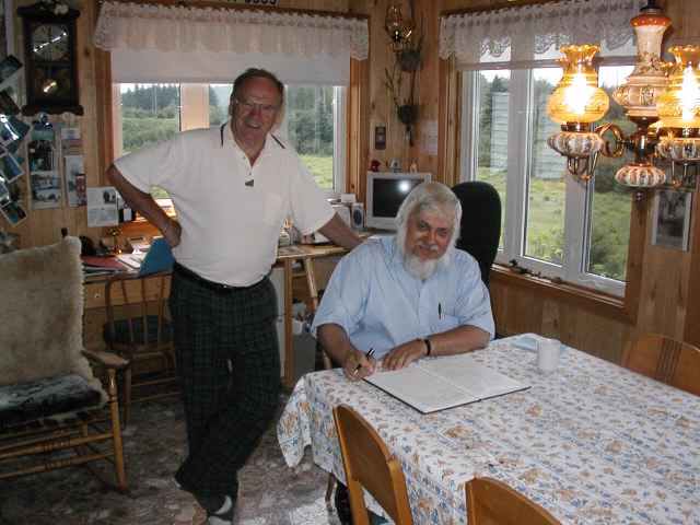
Unlike the B&B in England I went to a couple quarters ago, the owner and his wife also ate with us. I liked that. There was a lot of conversation in French that I didn't follow at all, but that was fine. I'm not sure what the conversation was all about, but at one point pictures of a flood were passed around. Occationally the conversation came around to me and there would be bits of English. The hostess also showed a scrapbook they have showing all the guests they have had. That is a nice touch to add to the usual guest book.
13:00 UTC - 15:00 UTC (Search for Charger)
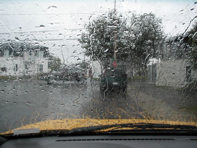
OK, once breakfast was over it was time to start searching for the random spot. Well, not quite. There was that matter of the cell phone charger. Now, I knew I'd be going places with no cell coverage, but I still wanted to have a working cellphone. I just didn't feel right without it. So I headed back in the direction of Chicoutimi figureing that I'd be able to find some sort of store that would have the charger I needed. It was pouring rain at the time.
I stopped at a Radio Shack I saw. Other chargers, not mine. A bit further down I found a mall with a Sears in it. Checked several stores in the mall. Lots of chargers, not mine. I saw a Wal-Mart. Wal-Mart must have it! Nope, other chargers, not mine. Then just as I was starting to dispair, I saw that in the same mall as the Wal-Mart was another Radio Shack. I walked in and almost immediately saw the charger I needed. Whew! I felt relived! I bought the charger and some AA batteries for my other gadgets. Then finally it was time to get under way in earnest. I had lost two hours on this chase and had driven away from where I had wanted to go.
15:00 UTC - 17:00 UTC (To Milot for Lunch)
My first destination was the town of Milot. From looking at all the maps I could find, I had determined that my best chance to get close to my point was to follow a road that started out at Minot and headed North from there. I'd ended up on my charger search just South of Chicoutimi, so I had to go back out past Chicoutimi, past Pignons Verts out toward Lac St. Jean, and then North to Milot. Right before I got to Milot I stopped and got some lunch.
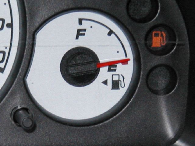
I was getting more comfortable with the whole orrdering food routine by this point, although it always remained a bit awkward. When I got to Milot proper there was not too much there. But there was a gas station. So I filled up to the brim, took a deep breath, and drove North.
17:00 UTC - 21:00 UTC (To the End of the Road)
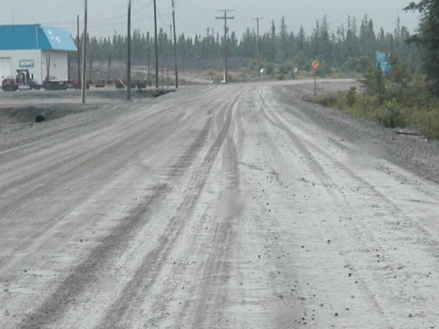
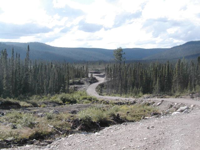
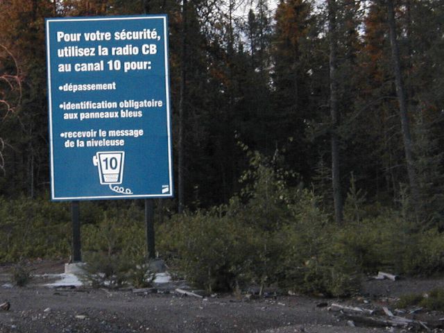
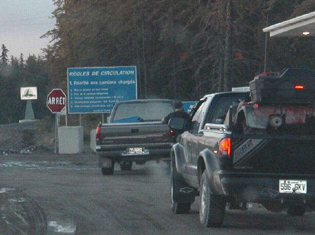
Shortly after Milot the road widened for a bit and there was a lot of activity and buildings. Lots of trucks parked, etc. There was a little booth my the side of the road with a stop sign next to it. I stopped, and then kept going. I later realized that I was probably supposed to stop there and do something at the little booth before continuing. There were also a bunch of big blue signs. It looked like they were lists of rules. But they were in French and I could only pick out a few words. Like CB Radio. It looked like it was saying CB radios were required beyond this point. Woops. I of course didn't have one. And it was too late, I had driven past the sign.The pavement ended and suddenly I was on a dirt road, all be it a well maintained wide dirt road. There were a couple last buildings but beyond that it was just a wide dirt road...
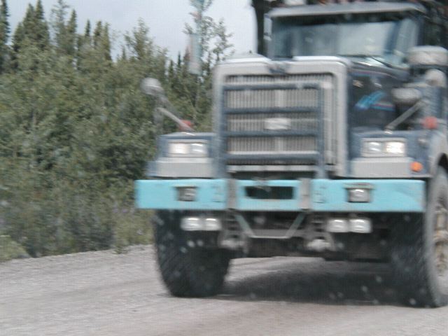
Every few minutes a huge logging truck passed by, loaded very high with lumber. They trucks looked increadibly top heavy, and as if they could turn over at any second as they drove by at excessive speed. I tried to take a picture of one, but whenever they went by, I was mostly concentrating on not getting run over, so this is the best I got.
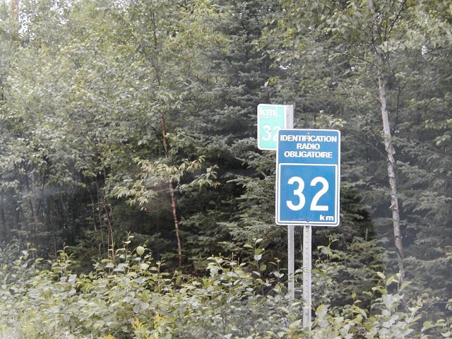
Basically the only other things I saw on the road at first were the lumber trucks. And I was starting to wonder just how many rules I was breaking by being here, and if at any second some mountie or some such would come racing up behind me and arrest me for being somewhere I shouldn't be without legitimate business, a licence, paying the fee, or having a CB radio. Then I started passing signs that seemed to indicate that when you passed them you were supposed to check in and report your location via CB radio.
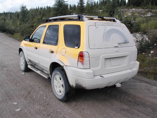
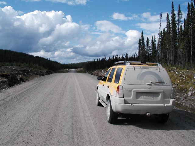
Woops. I was a rogue on the logging road. In a bright banana yellow Ford Escape. I was fairly nervous as I started out. Not having been able to read the signs, I had no idea what regulations I might or might not be breaking. But by this point I was fairly sure I was supposed to have a CB radio, and check in every few kilometers with my location. There were also signs like this. I could guess at what they meant, but I couldn't really read them. I thought they were funny though.
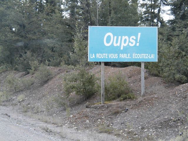
Later I had it translated. "Oops! (I got that part) The road is speaking to you. Listen to it!"
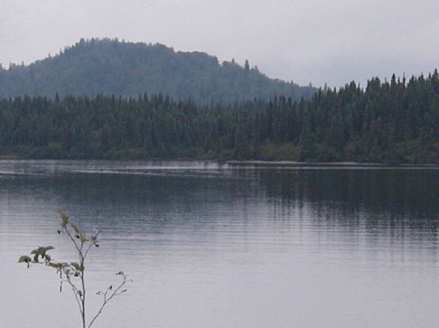
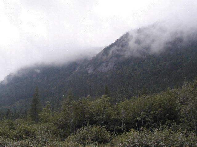
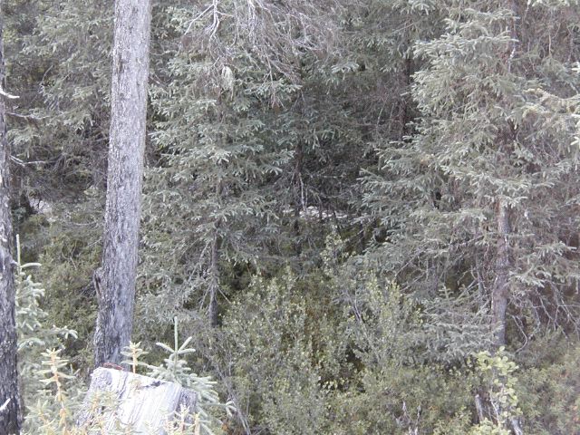
But as I continued and was more than half an hour from the "gate" and it looked like nothing bad was going to happen, and I saw a few other SUV type vehicles on the road, I began to relax and just enjoy the scenery. For the most part it was just absolutely beutiful pine forest, with lakes and mountains around every corner.
Every once in a while smaller roads would turn off to the side. Aside from the big logging trucks, you would occationally see evidence of logging activities.
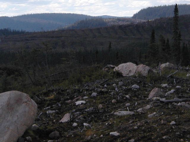
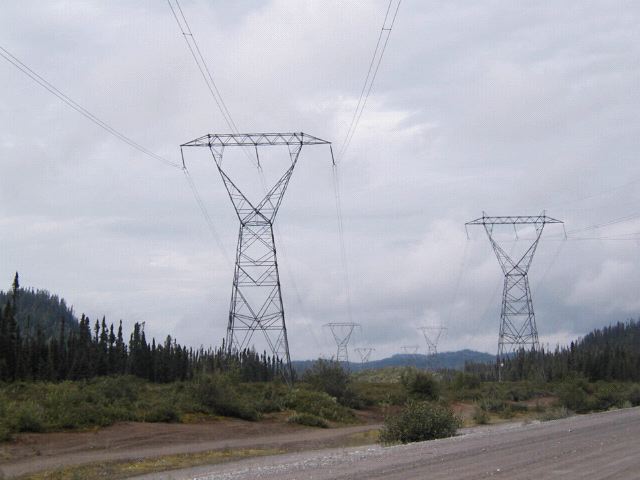
But for the most part you couldn't tell. In one area I passed there was a sign that said the area had been harvested and replanted in the 1980's and would be ready for reharvesting around 2030. There was a cute cartoon of a growing tree, but I didn't get it's picture. And in one place you could see another major reason this area had a road. Power lines from Hydro Electric Damns further North.
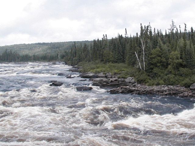
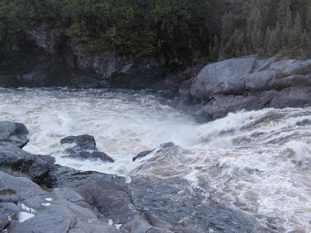
After a bit I crossed the Peribonka river on a small ridge over some rushing rapids.
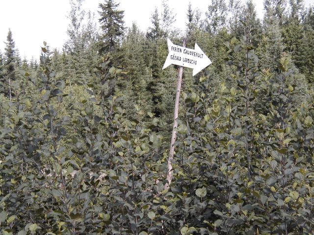
As I continued slowly the logging traffic died of. There was still some SUV traffic (all with big CB antennas by the way) but much less. There were still signs of human involvement though. The road itself was there, and obviously well maintained. But there were various signs pointing to the side with people's names.
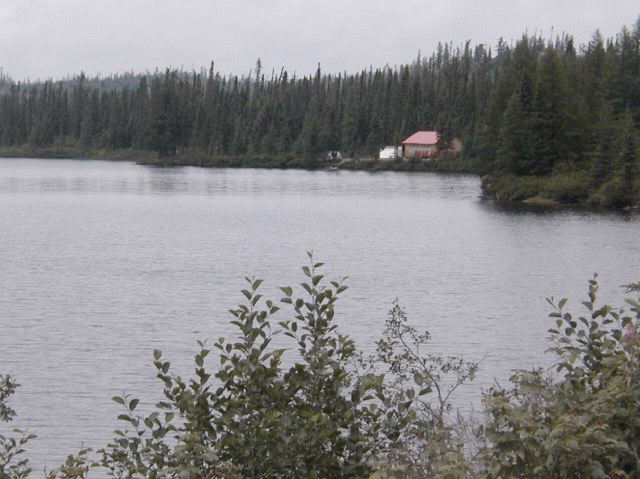
And occationally you could see where those signs were pointed. Little houses. Usually along the sides of lakes. Way out from the nearest town.
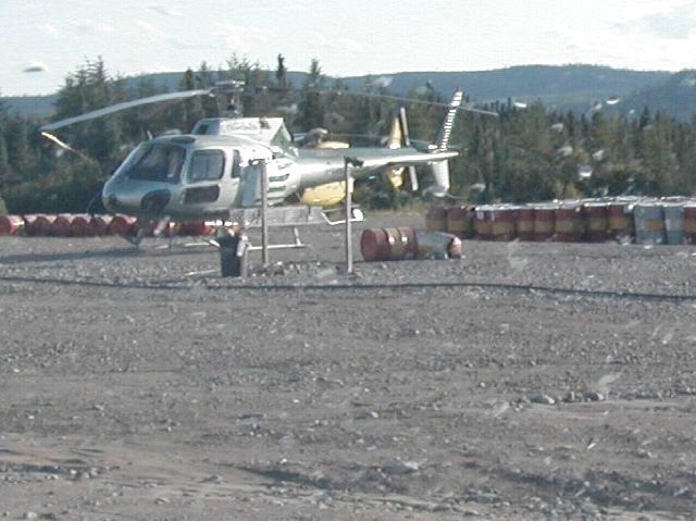
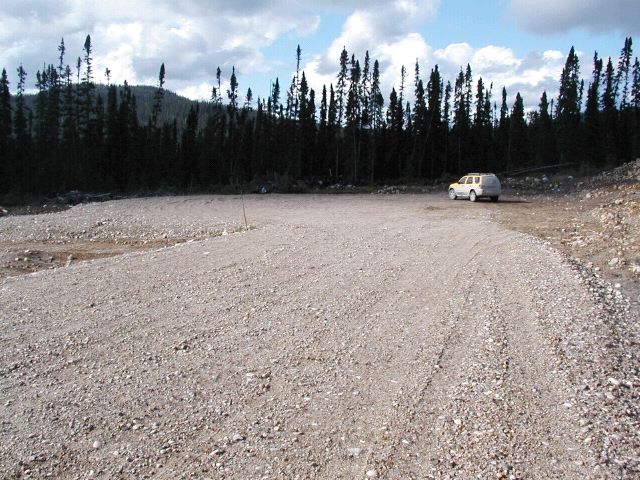
After around an hour and a half of driving, I got to "Chute-des-Passes". I think there was more down another road, but what I saw was just a small clump of buildings with a couple of helocopters parked outside.
This was the last "town" I had seen marked on my maps back home. It was also right near a fork in the road. I picked the one that my Topo maps indicated headed in the riught direction the farthest and started heading up the eastern side of Lac Peribonka.
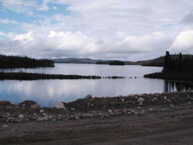
Usually you could not see the lake itself, but there were times where you could catch a glimpse or two of a litlte corner of it, or one of the smaller lakes around it.
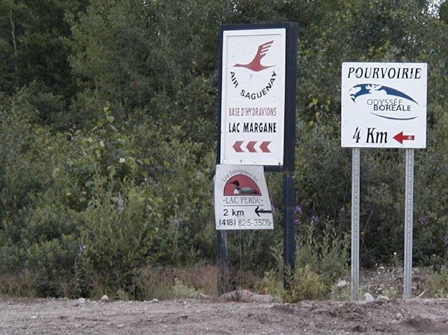
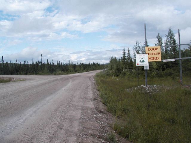
I would occationally see signs for an Air Sagueney. After a while longer, I saw a sign pointing down a small road saying it was just down in that direction. It seemed to be a sea-plane outfit. I made a note of it. Depending on how far I got and time, perhaps I would be able to charter a sea-plane to fly me over my actual random spot.
But for now, I kept going.
Then I reached 51° North, the point at which my GPS thought the road ended and showed nothing but lakes to the North. But the road continued.
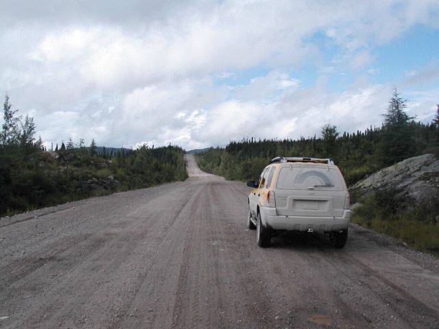
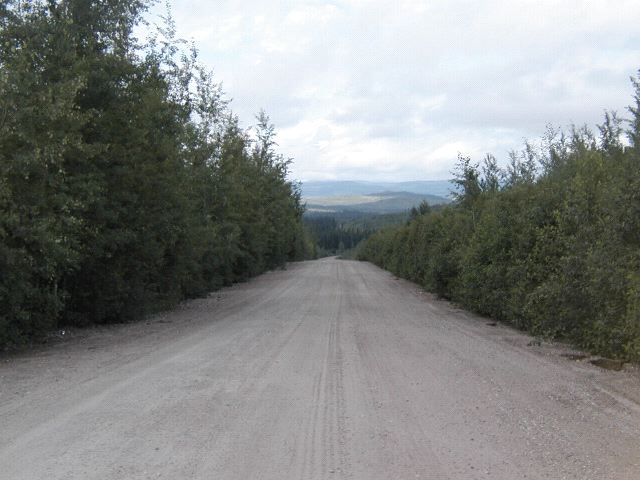
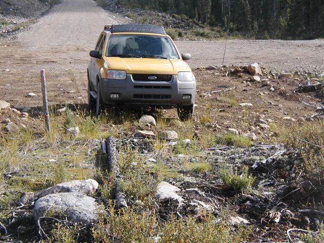
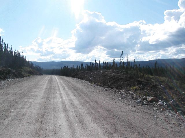
I actually had known it would continue though, because my paper topographic maps showed it continuing a bit further. So I kept going. As you can see though, by that time, after 100 miles or so on this dirt road, the car was filthy.
And the road ahead wasn't going to get me any cleaner...
There was one last fork in the road. It showed on my topo maps. It looked from the maps that I had that the road straight ahead turned away from where I wanted to go, and then petered out before too long anyway. The road to the left however, went in the direction I wanted, and went straight to the top of the map I had. So, of course, I turned left.
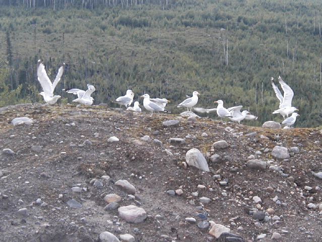
I passed one last logging camp "Camp Bonnard", and I saw some seagulls.
Then I reached 51°15' North... the top of one of the topographic maps I had. The next map, to the north, showed no road. But the road continued.
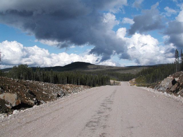
I had suspected it would continue, becuase the map to the south of this spot was made in the 1980's and showed the road right up to the top. The map I had to the North of this spot was made in the 1970's and showed no road. It would be a huge coincidence if the road actually had ended exactly there. Instead, the logical conclusion was that the road had been built sometime between when the two maps had been made. But now, past this point, I had no idea what to expect. I did not know where this road went, I did not know how far it went. If I came to a fork in the road, I would not know which way to go. And at this point I was no longer seeing other traffic on the road. It had been at least an hour since I had seen traffic going in either direction. It had been probably about 100 miles since I last had cell phone coverage. The last thing I had seen was a little logging depot (Camp Bonnard) with a couple of trailers and some pick up trucks parked out side. At this point that was a long way back. If for any reason I broke down, I would be in for a LONG walk back.
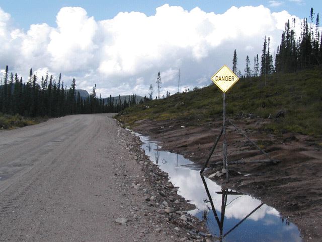
But I kept going. At this point I was less than 50 miles from my random spot. I had not been sure I would be able to make it even this far. But the road continued. And was still wide and well maintained, despite the lack of traffic or signs of current humans. As I was nearing the edge of the next topographic map I had, I was starting to get a bit nervous though. Signs like this didn't help.
I of course ignored it and kept going. (Although I did slow down for a bit and look around more carefully.) I was looking at the clock, and I was looking at my gas gauge. I still had a little more than half a tank. And it was still a number of hours until sunset. On sunset I could be flexible. I was nearing the time of day where it would be dark before I got back to paved roads and civilization if I turned around. But in at least the first part of this logging road there was traffic and signs fo life. I should at elast be able to get back to that part by dark, even if I went on a decent bit longer before turning around. I was more concerned about gas. I had filled up at the last gas station. There was only one way back. There would be no gas stations ahead. That meant that if I went even one little bit below half a tank, I would run out of gas before getting back to a gas station. So I had to be paying attention, and I had to be disciplined. As soon as the needle was touching the top of the half mark, I would turn around, no matter what.
Then, just as I was beginning to wonder if I would have to turn around while there was still road ahead of me, there it was. The end of the road.
All of a sudden the road just stopped, ended in a cul-de-sac.
Ahead were trees. Looking into the trees you could see the reason it ended right here. Although very thickly wooded, the ground level dropped into a ravine with a rushing stream at the bottom which you can barely see through the trees if you look carefully.
To go beyond here would require not just clearing the trees, but also building a bridge. And while I had gone over several bridges in the last few hours down this road, I supposed that they had gone as far as they needed to, and it wasn't worth it to them to build the bridge and keep going.
So this was the end. I walked around a little bit, then got back into the car. I did drive the car all the way to the edge, as far as I could, just to be able to say I did indeed drive as far north as I could on this road.
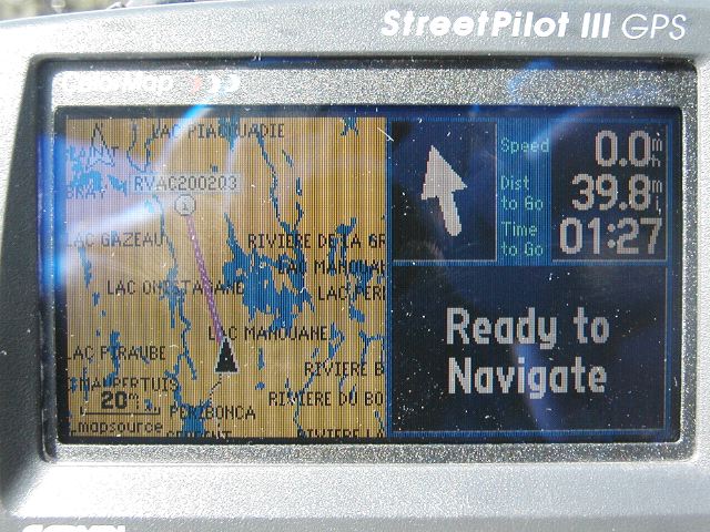
For the record, I ended up 39.8 miles from my random spot. This was the closest I was going to get by road, and going further on foot just wasn't in the cards. This was going to be it. But hey, I had driven North until the road ended. That was cool in and of itself. The GPS map showing my closest attempt to the spot is below.
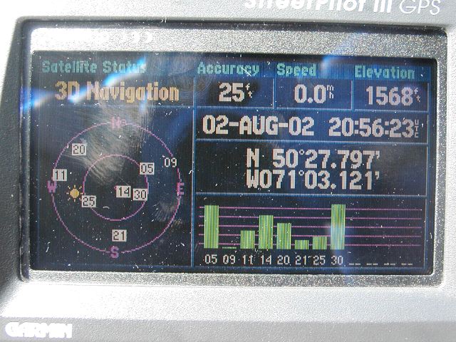
And my actual coordinates at that point...
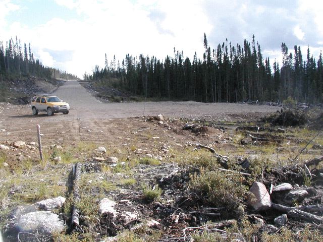
Then I got back in the car again, but before heading back in earnest, I explored one little side road that branched a quarter mile or so before the cul-de-sac, but it was just another dead end a few thousand feet in, and didn't get me any closer.
Then it was time to head home.
21:00 UTC - 00:00 UTC (Back to Civilization)
As I headed back I drove a bit faster than on the way out, mainly because I now knew there weren't really any places where I would suddenly drive off a cliff or something. I had been this way before, so I knew basically what to expect and went faster. The landscape was still increadible though.
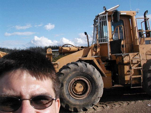
And occationally there was random construction equipment just sitting out by itself.
Before too long I arrived back at the turn off for Air Sagueney. I paused for a minute, then decided to go down that way. This despite the fact I was already at the point in terms of both time and gas that I should be hightailing it back to Milot as fast as I could. It took me down a twisty turny narrow dirt road (as opposed to the wide dirt road I had been on) for several miles. There were a couple other turn offs, but in the end, I passed a big sign for Air Sagueney.
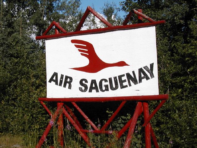
As I turned the corner I suddenly saw LOTS of vehicles in a parking lot. Well, comparitively, we're talking maybe ten. There was a place for the seaplane to dock, although I had seen it flying about an hour earlier, so it was not there. There were a series of cabins. And their was a trailer. Various of these buildings were labeled in French, but that didn't help me much. I was guessing the cabin was some sort of office. It has a windsock on it.
Right about then I saw a scuffy looking man walking. He looked at me for a second. Then he turned around to walk back toward one of the cabins. I could just imagine him saying "What the hell is that guy doing here?". At first I thought he was one of the people running the place, and expected him to come up to the car and talk to me. But he didn't. He just went away.
But he kind of spooked me. Instead of parking as planned, I just turned around. I was halfway back out before I realized what I was doing. I paused for a second. I should go back. I should walk up to the little trailer and find out how much it would cost to do the little flight I wanted. Up to the spot, circle a few times for me to take pictures, then back. I should do that.
Then the rationalization started. The plane wasn't here right now. They probably couldn't do it today anyway. I'd have to schedule for tomorrow. And then I'd have to get all the way back out here. Which I could do, but... there was that no CB thing. Maybe they would even give me a hard time about that now. And there was the language. If the person at the desk didn't speak English, how would I explain my bizzare little request through grunts and gestures? I mean, I'm sure I could, but... and what if there were other people in the office with real requests? And what if it wasn't really an office? I couldn't actually read the sign on the door. And did I mention it was getting late? I probably really should go now. I could always call them in the morning and try to make a reservatiuon from the B&B. The B&B guy could help me. Yeah, that was the plan, I should do that...
OK, all that went through my head, but the bottom line is that I WIMPED OUT. I got intimidated, the walking guy through me off, and I hightailed it out of there. I started kicking myself and getting mad at myself for not having at least parked, gone in the office and asked. Urgh! I was so mad at myself!!
But, now I was heading out and back. I passed beutiful scenery again, going in the other direction. I saw more hills and forests and rivers and lakes, from the opposite direction.
And then I was out. I was back at the "gate" I had gone right through in the other direction. I stopped this time to take a more careful look at what was there.
I still couldn't read the signs, but yeah... it looked pretty clear that I was supposed to have stopped in the little booth and registered that I was going in there.
I probably needed to certify that I had a CB (I didn't) and probably pay some sort of fee, and probably put some kind of sticker or something on the car saying I was OK. Woops. I hadn't done any of that.
Oh well, I'd gone in, I'd driven to the end of the road, and I was back out to "civilization". And a little bird was telling me it was time to get to that little gas station I'd used on the way in here.
So off I headed, toward gas, and away from the day's adventures.
Selection | Day 0 | Day 1 | Day 2 | Day 3 | Day 4